On Tuesday and into today, much of the United States east of the Mississippi River had a variety of early spring weather. From heavy snow and a Blizzard Warning in Michigan’s Upper Peninsula to tornadoes in Kentucky, we witnessed it all.
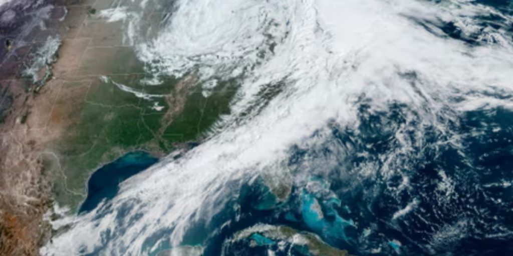
The Cooperative Institute of Meteorological Satellite Studies in Wisconsin (CIMSS) supplied this satellite loop, which shows the storm as it tracked across the middle of our country. The yellow colors represent the drier slot, coupled with the cold front, while the green and white hues represent the system’s precipitation and moisture levels.
The low-pressure system had a cyclonic spiral appearance, which is common with this type of weather and makes for an interesting image from a satellite.
On Tuesday, large destructive tornadoes, huge hail, and powerful damaging winds struck the southern Michigan area. Kentucky and West Virginia declared states of emergency as a result of the severe weather that devastated the southern tier.
A map of the Storm Prediction Center’s (SPC) storm reports for April 2 is provided below. The SPC categorizes severe weather reports into three types: tornadoes, hail, and damaging winds. Each is then classified according to strength, size, and/or intensity.
According to the chart above, yesterday’s threat was largely straight-line wind, with reports of hail and tornadoes. The entire cost of damage is estimated to be in the millions of dollars as everything is sorted out.
A massive cleanup effort has begun, which is expected to take months in certain areas that were affected particularly severely. According to early accounts, at least two people died and several dozen were injured.
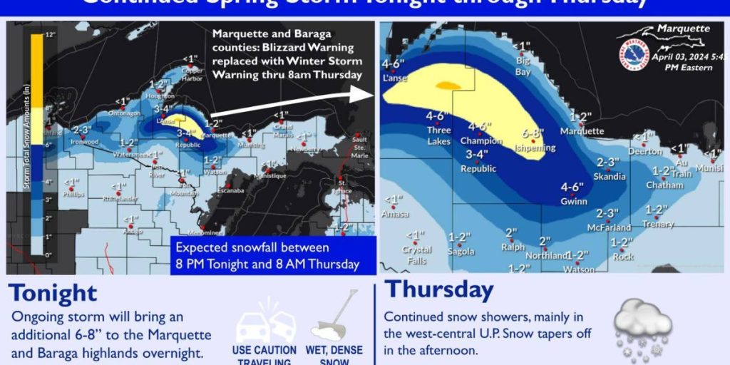
Parts of upper Michigan received a significant amount of snow yesterday afternoon and tonight when the low-pressure system rolled through. The bulk of the Upper Peninsula had snow, with some areas receiving up to a foot of heavy, wet snow. Downstate, the precipitation was primarily rain, but there was an abundance of it, with some regions receiving more than an inch. Above this paragraph is a radar loop from the majority of the event. The loop runs from approximately 2 p.m. to 8 p.m.
Many people may be curious about how much snow we got from this. The Community Collaborative Rain, Hail, and Snow Network (CoCoRaHS) is gracious enough to make its data freely available to the public. This organization makes an incredible effort to collect and report precipitation observations from local volunteers who run/manage their own weather stations and sensors.
The first image shows snow quantities for parts of the Upper Peninsula that received the full snow package yesterday. Up to 9 inches were reported around Marquette, with other areas receiving more. The northern counties of the Lower Peninsula received up to 4 inches of snow, according to the report. Many areas may have received more than 6 inches.