After a tornado touched down in St. Petersburg on Tuesday, the Tampa Bay area could witness another round of severe storms as our roller coaster weather trend continues.
Following a warm front, another cold front will move in beginning Friday night. The Tampa Bay area is now under a Level 1 (out of 5) threat of severe weather, or “marginal” risk. This threat is less severe than the Level 3 threat we witnessed on Tuesday.
The latest storm system is forecast to arrive in the evening and overnight hours of Friday night into Saturday morning.
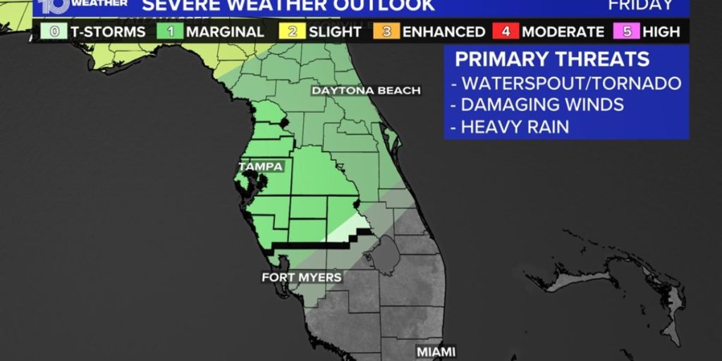
Strong to severe storms with damaging winds are the greatest threat, although an isolated tornado cannot be ruled out. Again, this threat appears to be less severe than what we witnessed on Tuesday. The exact timetable of this storm is still being developed, so keep watching for the most recent prediction trajectory.
Most of the Tampa Bay area is currently under a modest risk of severe weather, with bigger storms possible further north in the Southeastern United States along sections of Alabama, Georgia, and the Carolinas. The front is forecast to pass between 11 p.m. Friday and 6 a.m. Saturday.
Right now, significant storms with the potential to turn severe are likely to occur during the nighttime hours, so be sure you have a way to receive notifications to keep you and your loved ones safe.
While the last weather system that produced a strong line of storms rapidly went over the Tampa Bay area, this system is predicted to linger for a longer period of time. It’s not predicted to be severe, but the lingering system will increase the possibility of rain on Saturday and Sunday.