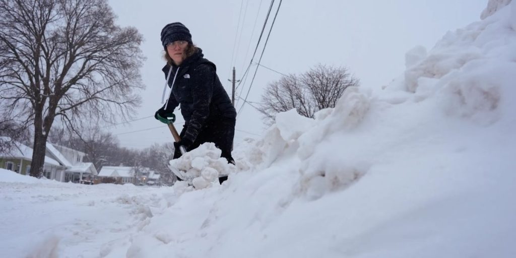
Winter has officially arrived in West Michigan, thanks to a major storm system that dumped heavy snow, followed by lake effect snow and an arctic blast.
Over 2 feet of snow fell in sections of Kent County between Friday and Sunday morning, with several other locations seeing double-digit snowfall totals.
Lake effect snow showers will continue to fall on and off throughout the rest of the week. This will result in extra light snow accumulation each day, particularly in regions west of US Highway 131.
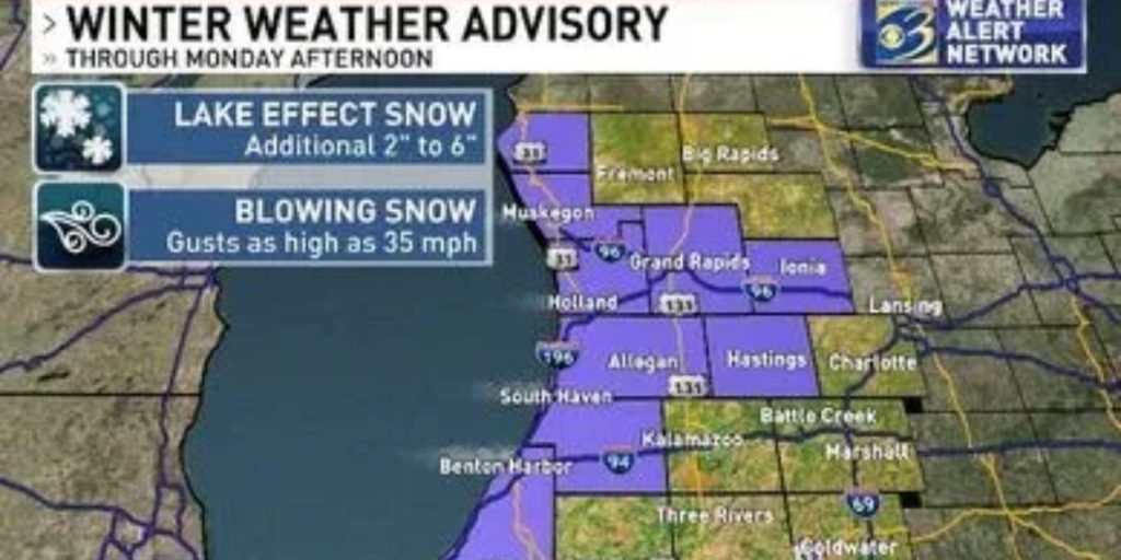
Until Monday afternoon, Allegan, Barry, Berrien, Ionia, Kent, Muskegon, Oceana, Ottawa, and Van Buren counties are under a Winter Weather Advisory. A further 2″ to 6″ of snow is forecast. The cold air has arrived and will stay with us for some time. This morning, a wind chill of -31 was recorded in Coldwater and readings that cold are predicted again tonight.
Until noon Monday, Barry, Berrien, Branch, Calhoun, Cass, Eaton, Kalamazoo, St. Joseph, and Van Buren counties are under a Wind Chill Advisory. Wind chills of -25 are forecast.
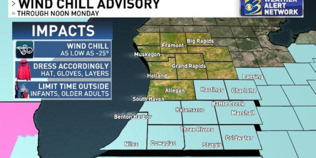
Frostbite can occur in 15 minutes with wind chills this low, so dress warmly if going outside.
This frigid air is not going anywhere. Monday and Tuesday are forecast to see highs in the single digits, which would be the coldest afternoon highs in five years!
Temperatures are expected to increase into the teens and 20s by the end of the week, although that is still well below average for this time of year.