The James W. Dalton Highway begins in deep Alaska and runs 414 miles (662 kilometers) north. This partially paved route, also known as Alaska Route 11 or Haul route, is one of the few ways to explore Alaska’s wilderness from a car. But exactly where does the Dalton Highway begin and end?
And, most importantly, what should you know before packing your car and embarking on “the road trip of a lifetime.”
‘The Last Road North’
The Dalton Highway passes through several notable locations in this remote state. If you follow it from beginning to end, you’ll pass through the Arctic Circle, the Continental Divide, and the Yukon River.
However, a map alone cannot convey to you how difficult and dangerous this journey might be. It begins a few miles outside Livengood, Alaska, which is 80 miles north of Fairbanks. If you drive all 414 miles, you’ll arrive in Deadhorse, near the Arctic Ocean.
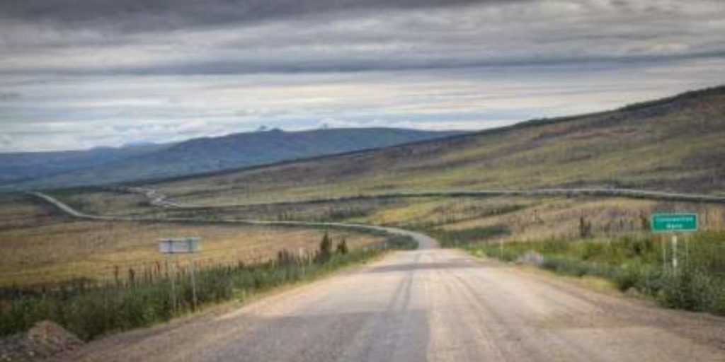
In between, you will find some of Alaska’s most remote areas, as well as some of the most stunning natural landscapes in the United States. That is if you are among the courageous souls who are willing to make the journey.
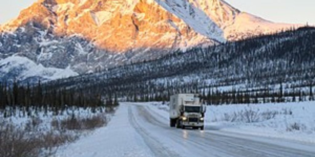
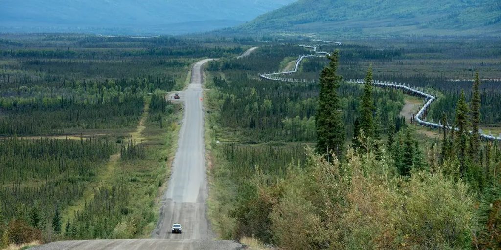
The Dalton Highway was completed in 1974, but not as a scenic path. It was designed primarily to serve as a supply route for the Trans-Alaska Pipeline, which it parallels. It was not even fully accessible to the public all the way to Deadhorse until 1994.
Considering its original function, along with the breathtaking views of the Alaskan wilderness, you’ll see commercial truck traffic transporting supplies to the oil fields.
Photographer Ben Huff depicts the contrast between wildness and industry in his book The Last Road North.
Also, Read: Cattlemen’s Steakhouse Voted for the Best Chicken-Fried Steak in Oklahoma
What You Should Know Before You Go?
If you’re considering a trip along the Dalton Highway, even if it’s only for a short time, there are a few things you should know first.
Don’t be fooled by the fact that the roadway, which is owned and maintained by the state of Alaska, is open all year. Not only is winter driving dangerous, but the circumstances on this highway do not necessarily follow a calendar.
Some areas of this road saw snow in July, and what the Alaska Department of Transportation (DOT) considers winter conditions can last from August to June. This implies that in order to travel safely on the Dalton Highway, you must be prepared.
As the Alaska Department of Transportation states, “This is not your average highway!”
- First and foremost, the vehicle you’re driving must be capable of handling rough terrain. An easy-to-manage four-wheel drive vehicle is required. Only a fourth of the road is paved; the remainder is gravel. You’ll also need plenty of emergency supplies.
- Extra food, water, fuel, clothing, first-aid supplies, and even extra tires are high on the list of items to pack.
- A CB radio, a popular device in the 1970s, is another must-have for this journey. This is how the large rigs communicate with one another. In an emergency, it may be the only method to call for assistance.
Learn More: 5 Most Dangerous Neighborhoods in San Jose, California
Many Miles Between Stops.
Don’t expect to see your regular rest sites along the Dalton Highway, either. After passing the Hilltop Truck Stop just north of Fairbanks, the next place to eat or obtain fuel is more than 100 miles north. The Yukon River Camp, an oasis in the wilderness, provides lodging, gas, gifts, food, and bathroom facilities.
With only three villages along the entire road, you’re completely on your own. Travelers are reminded that there are long gaps between services. Obtaining emergency roadside help “can be very expensive,” the state DOT notes.
The three towns along the way aren’t exactly metropolises, either.
They include Coldfoot, which has a population of only 34. Then there’s Wiseman, with barely a dozen people, and Deadhorse, with 25 regular residents. However, oil production workers can temporarily increase the Deadhorse population by thousands.
Read More:
- Explore 4 Most Devastating Bridge Collapses in Alaska
- Exploring the Secrets of the Most Haunted Place in Alaska
Breathtaking Views
Despite the dangers and hardships of traveling the Dalton Highway, it’s a once-in-a-lifetime opportunity to see the Alaskan wilderness in all of its beauty.
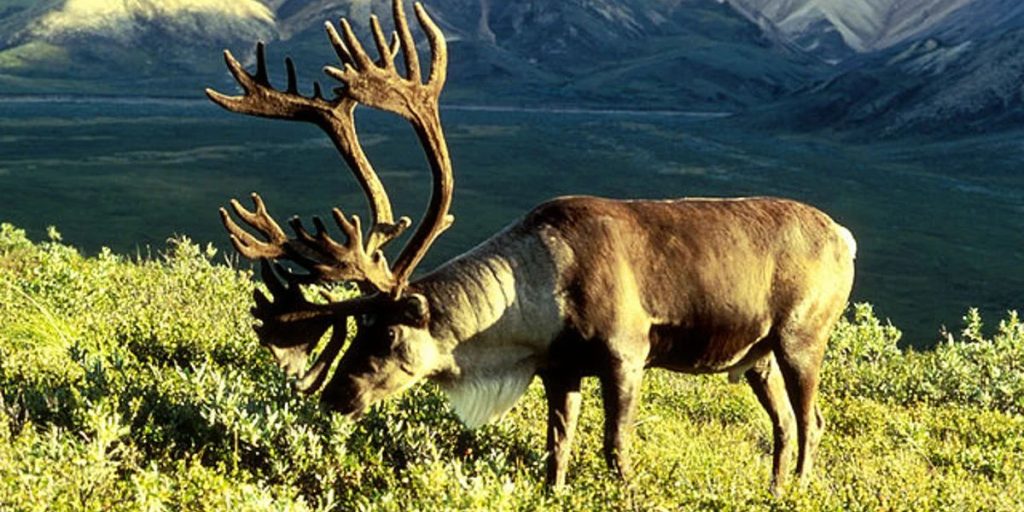
Its stunning landscapes include the summits of the Brooks Range, where thousands of caribou migrate each year over the northern tundra. The scenery is huge and varied. Depending on the time of year, you may observe geese, tundra swans, and long-tailed ducks along the route.
Arctic foxes and caribou are common throughout the year, as are falcons, hawks, and eagles. During the summer, the landscape is covered in grasses, mosses, lichen, and flowers. If you’re planning a full voyage, a shorter trip to the Yukon River Camp, or even simply an imaginative expedition into Alaska’s wilds, nothing else can “remotely” rival the Dalton Highway.